Data View
The Data View menu is used for enabling and disabling various types of data visualizations and 3D models in the scene.
Enabling and Disabling Data in Data View is essential for customizing the visual representation of your scene. It allows you to tell a story by showcasing specific aspects of the data, making it easier to analyze and interpret the information relevant to your scenario.
Note
Enabling or disabling data in the Data View menu does not delete the data from the scene. It only toggles the visibility of the data.
Accessing Data View


Using the Data View
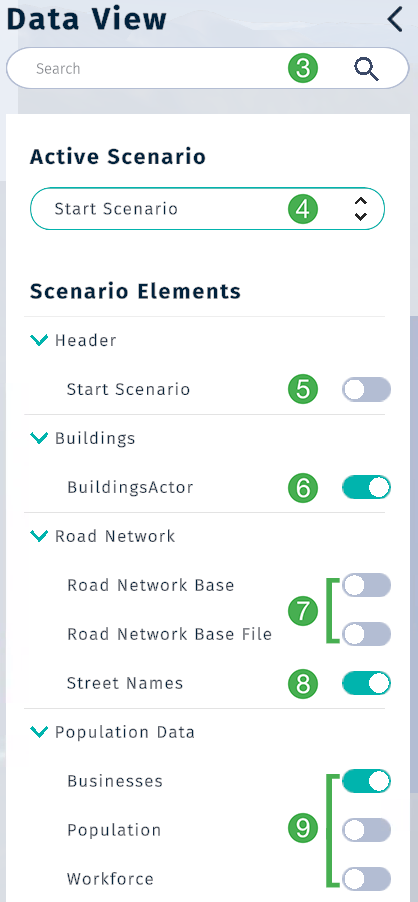
Data view section may have many different kinds of data depending on your setup. You can search for these by name here.
Active Scenario
Select your scenario from the drop-down menu.
Scenario Elements
All datasets added to a scene will show up under the Scenario Elements section. By default, a scene has buildings, road network and population data.
Toggle visibility of the header element. Learn more about adding or editing Titles and Subtitles.
Show or hide buildings in the scene by toggling the visibility of the
BuildingsActor.Road Network BaseandRoad Network Base Fileboth visualize roads based on their capacity and speed limit.Street Namesadds the street names to roads. Will be applied on top of any road network.Toggle to show relevant
Population Data. Please note: Only one population type can be enabled at the same time.Population Types
Businesses: Grid-based heat map of business density.Population: Grid-based heat map of population density.Workforce: Grid-based heat map of workforce volume (commutes to businesses in simulation).
Note
Population data is currently only available for Norway. If a scene is located outside of Norway, then similar datasets must be made available for this feature to work.
Data View Example
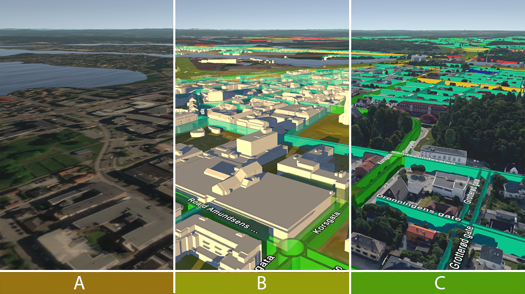
Rendering from a scene with different datasets enabled in the data view.
Terrain only
Terrain + Buildings + Road Network + Street Names + Business Population
Cesium World Terrain + Road Network + Street Names
Note
Cesium World Terrain is a global terrain and imagery dataset provided by Cesium. It can be enabled and disabled by toggling the F7 key. It is not available in all regions. If you are in a region where it is not available, the terrain will appear flat when enabled.